Corona Adventures: Paw Paw Tunnel
 |
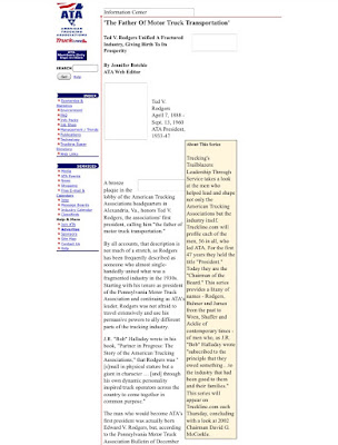
| Sophie and Annabelle prepare to take on the Paw Paw Tunnel |
I don't know about you (though I can guess), but I'm a little tired of being cooped up in the house. On the flip side, I don't really feel ready to jump back "out there." We just moved into the green phase of recovery on Friday (June 19), so a lot of things are opening up more, but by the same token it doesn't seem like there's been a ton of caution observed around here for the past month or so.
So what do you do when you seek adventure but most places are still a little too... peopley... for your taste? Well, if you're like us, you take advantage of your husband's oddball schedule, which gave him a day off on Wednesday (but meant he had to work on Father's Day 😢) and hope most people are working mid-week.

The Paw Paw Tunnel has been on our bucket list for awhile. It's across the river from the town of Paw Paw, W.Va., but still in Maryland. That's what we decided to check out on our adventure. We headed out I-70 to Hancock, where we cut down U.S. 522 -- noting, of course, that if we went north instead of south on 522 we would eventually end up in our old town of Selinsgrove -- and crossed the Potomac into West Virginia. Yes, you end up driving through West Virginia (Berkeley Springs and other spots on WV 9, to be exact), then crossing back over the Potomac into Maryland again to get to the towpath and tunnel.
The directions led us to a parking area with signs for the Paw Paw Tunnel and a bike path. Now, bikes are allowed on the towpath, but these signs seemed to specify a bicycle-only path. Plus, there was no indication as to how far off the tunnel was, and with little legs to take into account, we thought maybe we needed to find a closer access point.
We ended up winding down a back road and up a dirt road -- mud puddles and all -- to the Paw Paw Tunnel Trail, marked as a "C&O Canal Detour Trail." OK. There were historical markers to read along the way, much to Sophie's delight, so we decided to leave the car in the "parking area" and trek on from there.
It was a little... steep.
 OK, it wasn't that bad, but it was a little challenging trying to hike downhill on a shale-covered path with a 4-year-old clinging to one hand -- definitely a different sort of workout. I like to think I'm in decent shape, but the quad on my left leg (the side Annabelle was on) was sore for a couple of days, and the other leg wasn't. Go figure.
The trail meandered around a bit, but eventually we got to the towpath. To get to the tunnel, you have to walk a ways on what is essentially a boardwalk, built out next to the canal off of rocky outcroppings.
The tunnel itself is pretty cool -- literally. Joe said he could see his breath at one point. However, I was too busy looking at the path in the light of my phone's flashlight and trying to keep Annabelle out of puddles. It was also longer than I expected -- more than 3,000 feet, so you're definitely walking in the dark for awhile. If you go, take a real flashlight with you.
We learned some interesting history about the tunnel along the way. It took 14 years (1836-1850) to complete construction, in large part because they were digging it out of shale, which is soft and crumbly and requires hand tools. They tried explosives, but that resulted in a lot of deaths and injuries. It also had to be reinforced with bricks.

After we got through the tunnel, we stopped to eat our picnic lunch (yes, we brought along hand sanitizer and the like). The forecast was calling for thunderstorms within a few hours, so we decided to head back. Joe decided to head back up the Paw Paw Tunnel Trail, which apparently goes over the hill the tunnel goes through, get the car, and meet us back at the parking area we'd seen before. And here's where we realized our mistake: The end of the trail Joe took back to the car was only about .6 miles -- shorter than the direction we originally took. The parking lot? Maybe a half-mile away. I'm normally a pretty good navigator, but my instincts were waaaaaay off on this one.

All in all, a good adventure, and not too people-y!
Note: Any links provided in this post are for additional information. I am not paid to provide them.

Comments
Post a Comment